The War Department's 2026 National Defense Strategy, released Jan. 23, prioritizes defending the homeland as its first line of effort.
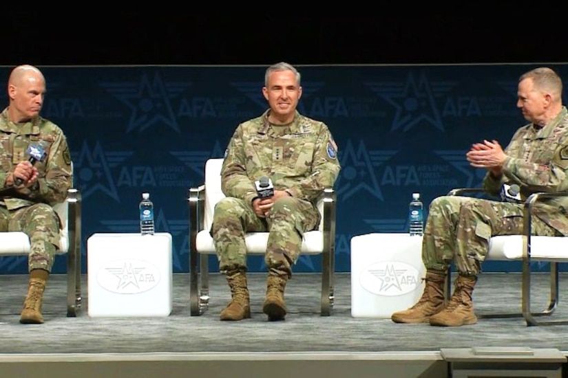
Yesterday, during a panel on homeland defense at the Air and Space Forces Association's annual warfare symposium in Aurora, Colorado, three senior Air and Space Force generals discussed how their respective combatant commands are working to do just that.
Space Force Gen. Stephen N. Whiting, commander of U.S. Space Command; Air Force Gen. Gregory M. Guillot, commander of U.S. Northern Command and North American Aerospace Defense Command; and Air Force Lt. Gen. Michael J. Lutton, deputy commander of U.S. Strategic Command, spent just under 45 minutes discussing what they view as the biggest threats to the homeland and how they foresee the development of the Golden Dome for America missile defense system, among other topics.
Regarding the threat assessment to North America, two of the three leaders agreed that cyberattacks from U.S. adversaries are near the top — if not at the top — of the list.
"The cyber threat is the most persistent and present threat that we have. I'm often asked when doing congressional testimony, 'What's our next attack going to be?' And I say we are under attack right this second in cyber[space] from nation states and proxies to them, trying to get into our systems to the tune of hundreds of millions [of] attempts a day," said Guillot, whose combined NORAD and Northcom commands focus on homeland defense in all domains.
Lutton, whose command conducts global operations to deter strategic attacks — particularly nuclear — and employs tailored forces to guarantee the security of the nation and its allies, concurred with Guillot's assessment.
"With respect to cyberspace, the ability of cyber to disrupt or deny or degrade — that has a different tempered dimension, if you will, than a ballistic missile [and] there's potential ambiguity with cyber that is very much a focus of [Stratcom]," Lutton said.
As commander of Spacecom — the command responsible for conducting, planning and integrating joint military space operations with allies to deter aggression, defend national interests, and defeat threats in, from and to space — Whiting said his primary concern is Russia's reported development of a space-based, nuclear-powered anti-satellite capability designed to destroy or disable satellites, particularly in low Earth orbit.
"If Russia were to launch that, of course, it would violate the Outer Space Treaty that they're a signatory to, [and] it would be an incredibly destructive and indiscriminate weapon that would hold all nations' space capabilities at risk," Whiting said.
"And, of course, that's just something that we wouldn't want to tolerate," he added.
In terms of the development of the Golden Dome — which President Donald J. Trump authorized via Executive Order 14186 on Jan. 27, 2025 — all three leaders said their respective commands are working closely together and with Space Force Commander Gen. Michael A. Guetlein, the director of the Golden Dome mission.
Guillot said that as soon as Guetlein was confirmed to lead Golden Dome, he flew out to meet with Guillot and Whiting to begin basic planning for the program.
"And the three of us left the room, without any exaggeration, 100% aligned with what we thought Golden Dome for America should look like," Guillot said.
He added that the program is moving along at such a clip that it might have demonstrable capability much faster than initially anticipated.
"When Golden Dome first was discussed, I think some thought it would be a 2040 … type of capability [but] it's not; it's much closer, and a lot of the capabilities are [already] there," Guillot said.